In the low 70's and mostly sunny. We hiked into the Moon House Ruin.
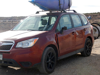
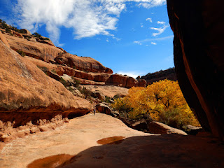
On our way driving across Cedar Mesa a 4 point buck leapt out the trees and ran into the side of the car. He got up, shook his head and walked off. The front fender, and both doors are dented and the rear view mirror got torn off. The good news is that we are ok and the car is still drivable, it is just hard to open the front door now. We continued to the ruin. The trail goes almost straight down the cliff, then you walk across the canyon and up the other side. This is taken from the ruin side of the canyon, the trail is where the shadow and the sunlit area meet. It was pretty steep.
There is one area of the trail where you basically slide down the slickrock to the ledge below. The first part of this photo is John sliding down. The two others are getting back up, it wasn't too bad after the first move. The ruin is in the shadow across the canyon.
John in the bottom of the canyon. John approaching Moon House Ruin. This Anasazi ruin consists of three cliff dwellings spread out along one quarter mile of the canyon. With a total of 49 rooms it is one of the largest prehistoric dwellings on Cedar Mesa. It is very fragile and they only allow 20 people a day in.
Moon house ruin. There are two different styles of building indicating that it was built by two different groups of during different periods of time. The rock wall parts that are built by the early people, they then later abandoned it. These pole and mud rooms were built at a latter date when different people moved into the vacant ruin.
A long defensive wall was built in front of the ruin creating a courtyard area. We could go into the ruin, but not into the rooms to protect them. The white dots above the white stripe here represent the moon. Inside the room the dots are supposed to be the different phases of the moon.
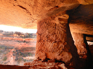
John in a shaft of dusty sunlight. A view from the outside of the Moon House ruin.
The mud construction here has handprints of the ancient Anasazi builder on it. It is kind of awesome to look at thousands of years old handprints. Makes it more personal. A granary for storing corn. They think the granaries contain enough dried corn for two years of food for the dwellers.
Farther down the cliff is this newer dwelling, nick named motel 6. It was built from stones that were taken from other older parts of the ruin and rebuilt here.
Looking down the cliff from Motel 6 at the older part of the ruin, it is hard to see in the shadow of the cliff.
Granary. This was built high up, John called it the loft apartment.
Inside the Moon room. The white dots are said to be different phases of the moon, but it is hard to tell. John leaping off the cliff to the ledge below. This trail is not for the faint of heart.
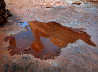
John back on the canyon floor by the big rock. The Moon House is above on the ledge by the big hoodoo. Reflection of the big hoodoo.
Looking back across canyon at the Moon House ruin. It is up on ledge below the overhang. It is well camouflaged. Some of the slick rock trail on the way back up.
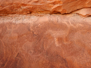
A view of the breathtaking Moki dugway carved into the cliff face, which winds 1,200 feet straight down from top to bottom on three miles of graded gravel at an 11% grade with numerous switchback with tight turns. The views are fabulous as long as you don't look down from the edge of the road. Some of the rock images on the wall above the cliff dwelling, some decorative details, a shard of ancient gray corrugated pottery, the leaves on the tree at our campsite are turning yellow from the outside in. A closer up shot of the phases of the moon. You can see a few crescents, but the other phases are hard to discern.
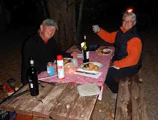
John cooked a great dinner for our friend Wanda over for dinner last night. We know her from Death Valley. She now works here in Bluff for the Bear Ear's education center. Fun to see her and dinner was excellent. We were going to eat out, but Bluff is a small town and all the restaurants are closed tonight. So John volunteered to cook. What a man! The light behind here is the flash reflecting off the car, but she claims it is her halo.